Waves crash along the shore sounding a harmonious hymn. A lone sea-gull cries a solo tune. A dozen others perched in the sand listen waiting for the cue that it’s their turn to chime in the chorus. A tern skips along the water’s edge adding a note or two of its own. This is nature’s symphony. The notes are not written. There is no maestro. It’s simple. It’s pure. You sit on the beach and listen. The sun gracefully bathes you with its warm rays. Your heart 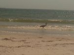 rate slows. You close your eyes. You are at peace.There are no high rises here, no tourist traps, surf shops, restaurants or bars. It’s just the ocean and the birds singing serenity’s song. Welcome to Fort De Soto Park, an island utopia surrounded by the waters of Tampa Bay and the Gulf of Mexico.
Located just a few miles from St. Pete Beach, you get to Fort De Soto from I-275 or from Gulf Blvd by route of the Pinellas Bayway. It’s a .50 cent toll road that is well-tended. The park also has its own toll of .35 cents plus a $5.00 admission per vehicle. You’ll see some of the most affluent coastal living in all of Tampa Bay as you drive the five-mile causeway through the Tierra Verde community. You’ll pass Billy’s Stone Crabs which has been around for over forty years! It’s hit or miss with the food and service, but it’s on the water so that counts for something. The locals prefer The Good Times Continental just off the Bayway. It’s more home style and ranked number one in Tierra Verde.
After crossing a couple of bridges, the boat ramps and camp ground are off to the right upon entering the state park. If you’re a camper, make sure you make reservations well ahead of any planned camping trips. The wait at Fort De Soto can be up to a year! The boat ramps are maintained well and provide plenty of space for parking, but you’ll still want to arrive early for a day of relaxation or fishing on either the bay or the gulf. It’s one of the more popular places to launch in Southern Pinellas County so it will fill up fast especially on holidays.
The Sunshine Skyway Bridge is only a short distance away by boat. It’s deep channels provide some top-notch fishing for species you might think you have to go fifty miles into the Gulf of Mexico to catch. My father used to tell me stories of going to the Skyway in search of the giant grouper (or jewfish) when he was a kid. I haven’t heard any tales of the enormous, man-swallowing beasts lurking those waters today, but who knows what lies at the bottom of the shipping channels? Other species of grouper, tarpon, king mackerel and cobia are there though. Experienced Captains track them down depending on the time of year. If fishing is not your thing, you can take the short jaunt out the mouth of Tampa Bay to Egmont Key. Known at night for its lighthouse, Egmont Key served as a first lines of defense during the Spanish occupation of Florida and as a U.S. military reservation until the latter part of the twentieth century. Today, it’s a wildlife refuge and only accessible by private boat or ferry from the Bay Pier in the park.
Once you get past the park entrance the activity choices are practically unlimited. Fort De Soto Park is divided into the north side and the east side. The causeway from the mainland ends at the ranger station from where you have to go either left or right. The east beach is to the left where you can see picturesque views of the Sunshine Skyway Bridge. The east side has plenty of fishing holes just off the road or places you can just poll over and relax. The east beach faces Tampa Bay. It’s marked by a large parking lot and restroom with showers. Just about everything else is on the north side of the island including two fishing piers, a gift shop, snack bar, bike rentals, canoe and kayak rentals, picnic areas, hiking trails, a pet playground and the highlight of the park, Fort De Soto itself!
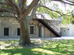 Fort De Soto was a military installation built in 1898 during the Spanish-American War. It is free to tour. Some of the last mortar cannons of their kind that still exist in the United States have been placed in the fort. Fortunately, a shot has never been fired from Fort De Soto. Though it was not used in battle, the fort has served in many training exercises over
 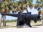 the years iincluding bombing practice for Hiroshima during World War II. I’ve been visiting Fort De Soto for 25 years. The view from the top of the western wall that looks over the park’s north beach with Egmont Key in the distance is one of my favorite places in all of Florida.
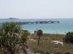
In the same parking area where you go to get to the fort, you’ll find the Gulf Fishing Pier and snack bar. This is one of the longer and wider fishing piers in the area where you’re always guaranteed to find good company. Access is free! Summertime brings in schools of spanish mackerel, jack, tarpon, and trout chasing bait fish that are so thick one drop of a bait net usually provides ample supply for a good day of fishing. Dolphin are common in the summer. They are bold, too. They tend to congregate around the pier. No catch is safe with these guys. They are not bashful about robbing a fisherman of his dinner before he can get it safely out of the water. Take it from an eye-witness. I’ve seen them come out of the water to snatch a catch off an unlucky tourists fishing line.
The seas are rougher and the wind is colder coming off the Gulf in the winter. Despite the chill there is a peacefulness to the Northerly unique to the park that far surpasses any bite the wind dishes. Sunsets from the Gulf Pier are spectacular regardless of the time of year. Following a summer thunderstorm, the sun drops from the base of the departing cirrus just above the horizon. As the sun sinks lower, the moisture from the dying storm paints an array of reds, yellows, oranges, and purples in the sky that can easily be compared to looking through a window into heaven from the Earth. It lasts only ten or fifteen minutes, but the impression lasts forever just like in a painting.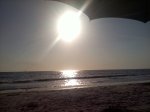
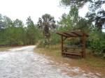
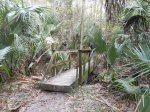
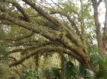
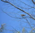
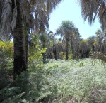
Fort De Soto Park harbors seven miles of paved trails that follow the shore and provide access to all the park’s amenities. You can travel within the park by foot, bicycle or car. Bike rentals are located at the north beach gift shop and concession stand. There are off-road hiking trails as well far to the north side of the island. The trails are convenient to the picnic areas so even on a cool winter day there is something to do to do if swimming or sunbathing is out of the question. The short hikes provide access to some pretty remote parts of the island so be sure to bring a camera! The palmetto scrubs quickly give way to coastal estuaries so the diversity of wildlife is pretty spectacular. From gopher tortoises and dozens of butterfly species to osprey and owl nests to the herons and egrets in the shallows, you are certain to find something worth shooting with a camera.


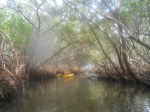
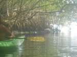
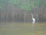
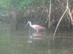
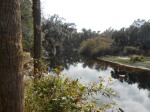
The interior portion of the island is called Mullet Key. This is where you’ll want to grab a kayak or canoe to explore the shallow mangrove channels. You may run into dolphins or manatees. You’re sure to get up close and personal with local native species of egrets, herons, pelicans, or maybe a limpkin, spoonbill or ibis. You’re guaranteed to get acquainted with the serenity of the park’s back country where Tocobaga Indians once lived.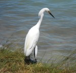
You can do all of this without ever stepping foot on what Fort De Soto Park is most known for…the beaches. Three miles of the seven mile coastline consist of white sandy beaches. Whether you park at the east beach parking area or you just pull off the road and take a short walk through the north side sea-grass to the shore, the park’s beaches offer relaxation at its finest. The beaches here are not as crowded as St. Pete, Treasure Island, or Clearwater. There no water slides or tiki bar bands to attract the masses. Two-time winner of the nation’s best beach, the stars of Fort De Soto Park are gentle breaking waves, long walks, first class shelling, wading birds pecking a snack from tide pools, pelicans skimming across the ocean surface, dolphins rolling in the distance, and the aerodynamic ballet of osprey fishing for their young. The park rangers regularly patrol the beaches so make sure to obey the rules. Most importantly don’t feed the sea-gulls or you will live to regret the company of some very undesired friends. The warm gulf waters bring many species of live shellfish near the shore during the summertime. The sand dollars can get so thick you practically kick them up with every step. You’re also likely to encounter sea stars, star fish and stingray so make sure to shuffle when you walk to avoid any unwanted encounters. Also keep in mind live shelling is prohibited so when you come across that starfish, resist the temptation to take him home. He’s happy where he’s at.
 Remember, your role is strictly an observer. Lose yourself in the opera before you. Let the stress of daily life melt away. Become one with the ocean’s symphony. Allow your heart and mind to synchronize with its melody. This small island utopia can belong to you for just a little while. Feel it! Treasure it! Protect and enjoy it! Nature’s song is what Fort De Soto Park is all about. All you have to do is listen.

Tags: Beach, best beach, bicycle, bridge, Canoe, causeway, Clearwater, De Soto, dolphin, east beach, Fishing, Fort De Soto, Fort De Soto Park, Gulf of Mexico, Hiking, kayak, nature, north beach, rental, shell, shelling, snack bar, St Pete Beach, St Petersburg, sunset, Sunshine Skyway Bridge, Tampa Bay, Treasure Island

